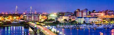
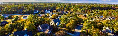
The South Carolina Neighborhood Explorer helps you to research any South Carolina neighborhood (census block group) and get home values, average household income, owner/renter/ occupancy rates, projected growth rates, boundary maps, comparisons to other communities, and much more.
South Carolina State Flower - Yellow Jessamine
The area of South Carolina was part of the original territory of the United States. Both North Carolina and South Carolina were included in the charter that established Carolina in 1663. The two areas separated in 1712—a separation that was finalized when the Carolina Colony was dissolved in 1729—with generally the same shared boundary as the present states. However, they did not settle on a final boundary until 1813. South Carolina ceded area to the United States to assume generally the same boundary as the present state; the ceded area became part of the Georgia and Mississippi Territory in 1802. South Carolina ratified the U.S. Constitution on May 23, 1788; it was the eighth of the original 13 states to join the Union.
Census data for South Carolina are available beginning with the 1790 census.
See: Geographic Terms & Concepts
Counties & County Equivalents
Interactive Map of South Carolina Counties | Static Overview Map of South Carolina Counties
There are 46 counties in South Carolina. All counties are functioning governmental units, each governed by a county council.
-- Select County --
Abbeville County
Aiken County
Allendale County
Anderson County
Bamberg County
Barnwell County
Beaufort County
Berkeley County
Calhoun County
Charleston County
Cherokee County
Chester County
Chesterfield County
Clarendon County
Colleton County
Darlington County
Dillon County
Dorchester County
Edgefield County
Fairfield County
Florence County
Georgetown County
Greenville County
Greenwood County
Hampton County
Horry County
Jasper County
Kershaw County
Lancaster County
Laurens County
Lee County
Lexington County
Marion County
Marlboro County
McCormick County
Newberry County
Oconee County
Orangeburg County
Pickens County
Richland County
Saluda County
Spartanburg County
Sumter County
Union County
Williamsburg County
York County
County Subdivisions
There are 299 county subdivisions in South Carolina. They are all census county divisions (CCDs), which are delineated for statistical purposes, have no legal function, and are not governmental units.
Places (Incorporated Cities, Towns & Census Designated Places (CDPs))
South Carolina State Bird - Carolina Wren
South Carolina has 395 places; 269 incorporated places and 126 census designated places (CDPs). The incorporated places consist of 69 cities and 200 towns. Incorporated places are each governed by a city or town council.
Alphabetical List of Cities, Towns, CDPs and Other Populated Places A | B | C | D | E | F | G | H | I | J | K | L | M | N | O | P | Q, R | S | T | U, V | W, X, Y, Z
South Carolina Civil Features
South Carolina Civil Features : Political Subdivisions, Native Areas, Land Grants, etc. - sorted by Census Class Codes .
Metropolitan and Micropolitan Statistical Areas
There are 8 Metropolitan and 8 Micropolitan Statistical Areas in South Carolina. SC Metopolitan & Micropolitan Areas
South Carolina ZIP Code Tabulation Areas
There are 424 ZIP Code tabulation areas (ZCTAs) in South Carolina. View South Carolina ZIP Codes and ZIP Code Maps .
School Districts
South Carolina has 2 elementary school districts, 2 secondary school districts, and 86 unified school districts. Two of the unified school districts are run by the Department of Defense. View South Carolina Public and Private Schools .
Congressional Districts
South Carolina has 7 congressional districts. An interactive map shows the contact information for each Representative as well as the boundaries for each South Carolina district. View Map of South Carolina Congressional Districts .
State Legislative Districts
There are 46 state senate districts and 124 state house districts in South Carolina.
American Indian Areas
South Carolina has one federally recognized American Indian reservation and six state designated tribal statistical areas (SDTSAs).